Central Midwest Water Science Center
Central Midwest Water Science Center
Central Midwest Water Science Center
Central Midwest Water Science Center
Welcome to the Central Midwest Water Science Center’s (CMWSC) Website. We offer information on streamflow, water quality, water-use, and groundwater data for Illinois, Iowa, and Missouri. We conduct unbiased, scientific hydrologic investigations & research projects to effectively manage CMWSC and our Nation's water resources through joint efforts with our partners.


News
Friday's Findings: Environmental Contaminants and Agricultural Production
Friday's Findings: Environmental Contaminants and Agricultural Production
StreamStats regression equation updates for Illinois
StreamStats regression equation updates for Illinois
Southeast Region (SER) Science Workshop: Identifying Science to Meet Administration Priorities and the Needs of Our Stakeholders
Southeast Region (SER) Science Workshop: Identifying Science to Meet Administration Priorities and the Needs of Our Stakeholders
Publications
Simulation of hydrodynamics and water temperature in a 21-mile reach of the upper Illinois River, Illinois, 2020–22
This report describes the development of a CE-QUAL-W2 river hydrodynamics and temperature model of a 21-mile reach of the Illinois River including a 3-mile reach of a major tributary, the Fox River. Model outputs consist of streamflow, water velocity, water-surface elevation, and water-temperature time series that can be used to simulate summer conditions in years with and without extensive develo
Special Contributing Area Loading Program user’s manual
The Special Contributing Area Loading Program (SCALP) is a hydrologic routing program that simulates reservoir routing through a linear-reservoir-in-series method. The Java version of SCALP was developed to replicate and replace the functionality of an older version of the program written in Fortran. SCALP models flow through three reservoirs in series using an input runoff depth time series and i
Evaluation of metrics and thresholds for use in national-scale river harmful algal bloom assessments
The spatiotemporal distribution of harmful algal blooms (HABs) in rivers remains poorly understood, and there is an urgent need to develop a consistent set of metrics to better document HAB occurrences and forecast future events. Using data from seven sites in the Illinois River Basin, we computed metrics focused on HAB conditions related to excess algal growth and hypoxia. Daily mean chlorophyll
Science

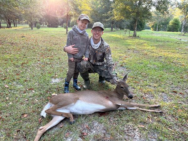
A National Assessment of Pesticide, PFAS, Microplastic, and Antibiotic Resistance Gene Exposures in White-Tailed Deer
Research has documented exposures and consequential environmental health effects of pesticides, PFAS, microplastics, and antibiotic resistance genes in environmental biota. Little is known, however, regarding such effects in white-tailed deer ( Odocoileus virginianus ).

Groundwater Monitoring in McHenry County, Illinois
Groundwater Monitoring in McHenry County, Illinois

Airborne Electromagnetic (AEM) Survey 2023 - Illinois River Basin
The U.S. Geological Survey (USGS) is conducting an Airborne ElectroMagnetic (AEM) Survey starting in late January 2023 and lasting three to four weeks. A helicopter towing a large hoop from a cable will begin making low-level flights over the Illinois River Basin, covering much of central Illinois and parts of northwest Indiana.


")